Monday, January 26, 2015

Not working out again in 2014-2015


From the top down: Snowfall has been truly dreadful in the Sierra Nevada. The slide at the top is from NOAA in Reno.

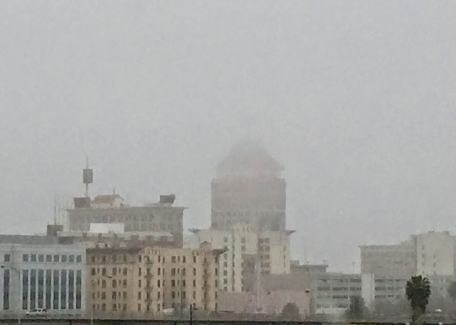
The center photo is downtown Fresno last Thursday. We expect this stuff here in January. We just don't expect zero rainfall, which is basically what January has shown us this year so far. Let's hope we see rain on Jan. 27.

The bottom photo is fantasy land. It's the view from Panoramic Trail in Kings Canyon National Park. That's Hume Lake in the distance. And that's a whole lot of snow from many years ago. It does not look like this now.

This is the four bad winter a row, so far. My snowshoes are drying up and blowing away in the garage.


Friday, September 20, 2013

Water for great coffee, though no moose

Water from a glacial tarn above the tree line tastes like it just came out of a tap in northern Maine. At least, that's what I think.

I never thought I would taste water as cold and pure as the water we drank when we spent eight days in Maine a few years ago. We rented a place about a mile from the gate at Acadia National Park. The only thing missing as a moose.

I have had plenty of water from high Sierra tarns, but never really paid much attention until after that trip to Maine. Now I notice.

The little body of water in the photograph is in magnificent Dusy Basin, which was an easy hike from South Lake west of Bishop. The pass is about 12,000 feet, but you really don't have to work very hard for very big reward on the other side in Kings Canyon National Park.

In the photo above, I was getting water for coffee one morning. Starbucks instant never tasted so good. It was Italian roast. All I needed was a bistro table, a few chairs and an indolent morning. There are no moose up in Kings Canyon, but I didn't miss it this time.

Saturday, March 30, 2013

Lousy winter, wimpy snowpack, but not really a record dry season


Most major California news outlets reported last week that January, February and March were the driest on record. Were they right?

Yes, if they said they were talking about the Northern Sierra. Otherwise, no. Most of the ones I read did not qualify it. My colleague at the Sacramento Bee, Matt Weiser, said it correctly. But I didn't read any others who did.

And, even if it was a record for the Northern Sierra, it hardly makes this a desperately dry year, as some outlets portrayed it. Take a look at the eight-station index on the state web. It's tracking close to last year.

In other words, there was a lot of precipitation in November and December. The snowpack is nothing to write home about -- about half the average. The photo above was taken by photographer Mark Crosse from a helicopter last week above the Kings River watershed. He was photographing a disappointing snow survey.

This is California's wet season. Sporadic. Tempestuous. Capricious. It's the land where average happens once every decade or so.

If the reservoirs were less than average right now (and they are not), it would be time to worry. Now, if we see a wimpy winter in 2013-14, it will be time to worry.

Sunday, November 18, 2012

A lawsuit to get Hetch Hetchy back?

Sitting in a Fresno coffee shop just after the Nov. 6 election, I heard a conversation that was just too delicious to ignore. I'm paid to be nosy anyway. And it was a pubic place.

OK, so I felt like I was peeping.

But this was just too good. Two guys -- I'm sure they were lawyers -- talked about San Francisco voters rejecting a study to restore Hetch Hetchy in Yosemite National Park.

To me, it was no surprise -- the vote, not the conversation. SF has used water from Hetch Hetchy Reservoir in the national park for nearly a century now. Why should they vote to give it back and pay higher rates for water from a lower reservoir.


Who volunteers for something like that?

It's a volatile subject and far more complex than I just stated it, but you get the picture. The only upside for SF would be a claim to be top greenies in the country. Well, that didn't happen. 


You need to know Hetch Hetchy bitterness runs very deep among some environmentalists. This is a gorgeous glacial valley filled with Tuolumne River water. San Francisco gets some of the purest big-city water in the country. It's a stinging environmental loss that has festered a long, long time.

You need to put that emotion in context every time you talk about Hetch Hetchy. Now, I'll play back the conversation from memory.

Says one lawyer: “Well, I’m not surprised San Francisco turned it down. Do you think people living here would vote to even consider restoring the San Joaquin River?”

Answers the other: “No, but …”

“Do you think Los Angeles would vote to restore the Owens Valley?”

“No, but there are big differences between those examples and San Francisco," says the second guy. "The San Joaquin is a mess downstream. It needs fresh water. It needs to be restored.


"And LA stole the Owens Valley water. People in the Owens Valley were put out of business over it. There’s no comparison to Hetch Hetchy.”

“You don’t think Hetch Hetchy damaged anything?” asks the first guy.

“Not legally. Show me the damaged party, and we can suggest they file suit. The San Joaquin River and the Owens Valley were both settled by lawsuits. I don’t see a lawsuit here.”

First guy: “But don’t you think people have a right to see Hetch Hetchy Valley? It’s a national park, for crying out loud. People are fighting mad about it.”

Second guy: “I’m with San Francisco on this one.”

"So the public's right to see that valley doesn't matter? We need a lawsuit to restore something important to us?”

“Yeah.”


"Even something as big as a glacial valley that the whole world would see?"

"Yeah. And, yeah. You need a lawsuit."

Yeah. Pretty much.


Thursday, August 23, 2012

Darwin Canyon, a mysterious, jagged, glacial countryside


This is Darwin Canyon, just below Mendel Glacier in the Southern Sierra. We came through here on our way to look for ice mummies on Mendel, which is several hundred feet -- maybe 1,000 feet -- above this canyon.

It's in my top five Sierra destinations because you can't here without a lot of work. Stark, wind-blown, jagged. We camped next to a glacial tarn near these others. They are ice-cold, beautiful and pure. It's a granite paradise on the trail less traveled. And that's because there is no trail to this spot.

You have to love this for the sheer size and primitive surroundings. We moved up and down canyon head walls that were more up and down than anything else. The Southern Sierra is breathtaking. We slept at about 11,500 feet -- an elevation where us flatlanders have trouble breathing the first night. We scrambled past house-sized boulders strewn all around as glaciers retreated 12,000 years ago.

 I pitched my small tent on a little ledge above the tarn. Turns out, I was on someone's turf -- a pika who let me know about it for hours. Whistling and carrying on. These little mouse-like critters with big ears are slowly running out of high country to live as the climate warms up.

Among the people who work on California water issues, I wonder how many have come up to these places. Climate change will take its toll up. Up here in the subalpine, the little glaciers will melt. There will be less snow. But it will remain the last stronghold for the snowpack, which provides more than two-thirds of California's summer stash of water.

By the way, we climbed up the rocky moraine, picking our way through Class 3 bouldering to get onto Mendel Glacier, one of the spookiest places I've ever hiked. We didn't find ice mummies from that ill-fated 1942 crash. But was saw engine parts, a wing and plenty of debris that was surfacing from the melting glacier above. We scrambled the next day over the Sierra crest in a hail storm and went back to our lives. But we will not soon forget this place.


Saturday, July 7, 2012

Huntington Lake in February


You need snowshoes to get here, but it's really one of the nicest hikes I've ever had.

I did it regularly over the last decade. I used to drop my son off at Sierra Summit so he could snowboard with his friends all day. Then I'd walk across Highway 168 and start down the snowy access road to Huntington Lake.

 In late December, January and most of February, the snow is fluffy and fresh. It doesn't turn firm -- Sierra cement, as it's called -- until March and April.

 The snowshoes help you just float over the road and down to what would be the water's edge in summer. But the lake is drastically lower in winter.

 This is a hydroelectric lake, part of Southern California Edison Co.'s chain of lakes up here. You can see the stumps of red fir and lodgepole pine in the lake bottom. This is not a natural lake, but it's certainly part of California's water picture. Hydro power is an important part of the state's energy portfolio.

 Sitting on a snowy edge of a rock, listening to Big Creek flow into the lake, I once drifted to sleep early one afternoon and a snow shower woke me. There's nothing like waking up in the middle of silence by the sound of little popcorn snow balls pelting you. As the squall line moved in above the western ridge, I strapped the snowshoes back on and made my way to Sierra Summit.

It's a short walk. The elevation is about 7,000 feet. It's perfect for me what I'm feeling like I need to get out of the city for a day.

Thursday, July 5, 2012

Thousand Island Lake, at 10,000 feet

My top five Sierra destinations are going to be published here over the next few weeks. They all have something to do with water. Really, there is very little in the Sierra that does not have anything to do with water.

 The picks are in no particular order. The first one is a sentimental favorite. It's in the photo above: Thousand Island Lake.

 It's sentimental for me because it is the headwaters of the San Joaquin River main stem. From here, the river flows more than 350 miles to the Bay-Delta and Pacific Ocean.

 The headwaters was so compelling for me when I wrote a 14-page section about the San Joaquin's revival. The section came out in 1999. The restoration agreement was signed in 2006. I was a tad premature, but the story was correct.

 This place is so gorgeous. About 10,000 feet, it is one of the best hikes I've ever experienced in the Sierra. We saw it during a backpacking trip that started at Red's Meadow and ended at Tuolumne Meadows in Yosemite National Park.

It's not far from Rainbow Fall, another wonderful Sierra landmark associated with the San Joaquin River. While the restoration gets most of the media attention, the water comes from up here. Without this part of the equation, there is no multibillion-dollar farming industry and no downstream debate about what has happened since Friant Dam was built in the 1940s.

Tuesday, February 14, 2012

When it starts to look like this in Yosemite...


This is the view from Sentinel Dome above Yosemite Valley this week. Half Dome is always the landmark you want in the middle of these shots. Everybody knows what it looks like.

But not everybody understands how important it is to see the dome covered with snow. It's an indicator of the Sierra snowpack. If you don't see snow up there most of the winter, you've got a water problem.

And if you followed the webcam that takes these photos, you know we have a problem. Most of November, December and January, there was no snow up there. The snowpack stands at about a quarter of the April 1 average.

The state had a monster year last winter, so it's not a statewide emergency yet. The reservoirs are still fairly full. That's why people aren't making a scene about this yet. But they will worry next fall. A second dry year will make life very difficult for farmers, cities, industries and hydroelectric power producers.

One more time: Look out across the rooftop of California in the background of this photo. That's where your water comes from. More than half of the state's water supply melts slowly and thunders through these granite canyons down to 37 million people.

Saturday, January 21, 2012

No place like this on Earth in deep winter


When I saw this photo a few years ago, I remembered scenes in Yosemite Valley like this from the 1990s when I started covering Yosemite National Park as a beat for The Fresno Bee. It's the best place on Earth in deep winter. This photo tells you why.

The photographer, Kenny Karst, works for park concession, but not as a photographer. He was head of the public relations department when he took this shot. I think his photo work is really nice.

Anyway, Yosemite Valley is fascinating in winter. There are very few tourists in the valley when it snows like this. Sometimes the temperature drops into the teens after a big storm, and it really is a slice of icy heaven.

Surrounded by the ancient, granite cliffs, you can sense what it was like when this valley was filled with ice during glacial times. The largest glacier in the Sierra was in the next watershed north of Yosemite Valley. It's called Hetch Hetchy Valley on the Tuolumne River.

We'll talk a little more about the dam and the reservoir stashed in Hetch Hetchy.

Sunday, January 15, 2012

Might not need to worry about snow patches this August


Last August, there was still snow all over the place in the high Sierra. This photo was in the Southern Sierra, just east of the crest.

Trust me, unless the winter gets rolling a little bit soon, this snow patch will not be around.

The hiker's name is Tim Crosse, a 20-something guy who likes seeing nature up close. By the time we were finished with this backpack, he knew what a Sierra glacier looked like. He had listened to the gentle drip at night as the snow and ice melted. He drank ice-cold water from a glacial tarn.

He's one of those youngsters who likes to check things out before he makes decisions -- like casting a vote. I won't get into the connection between water and California voting. That's a subject for a different blog.

Back to the high Sierra, I think it's really important to show the next generation what's up here and connect the dots. I know plenty of people, young and old, whose world is inside four walls. That was true for me when I was 20 years old.

I'll have a few more blogs soon about seeing California up close. And you don't have to put your phone on vibrate. I'm hoping to get you into places where there is no cell coverage.

Sunday, January 1, 2012

Southern Sierra may hold a climate key


I'm heading again into the glacier belt in the Sierra Nevada to get a closer look at where California's water starts.

I'm not saying exactly where I'm going yet, but you will definitely recognize it a lot easier than the photograph I've loaded with this blog item. The photo was taken in August at Dusy Basin in Kings Canyon National Park.

The glacial wilderness above 10,000 feet in the Sierra is often quite arid during the warmer months. But the Southern Sierra is the highest part of the mountain range. The snow tends to stick around all season long on many years, no matter what's going on elsewhere.

What does that mean for California as the planet warms?

I asked a fishery biologist who has had a lot of influence around the Sacramento-San Joaquin River Delta. Peter Moyle told me these wind-blown plateaus and peaks may be the last place where a decent snowpack remains in the future.

And that means what to the state? Remember, there are two rivers flowing to the delta. The vastly more important Sacramento River carries a lot more water, while the San Joaquin is considered a kind of murky mess.

But a restored San Joaquin with real snowpack 70 years from now might become a more important piece for conservation.

More later. And, by the way, I've decided not to take experts with me this year. Instead, I'm going with a fresh-faced young man who represents our future. Again, stay tuned.

Monday, September 19, 2011

A friendly yellow-bellied marmot


I had to sweet talk this yellow-bellied marmot for 20 minutes to come out from under a rock at 11,500 feet in August. I think he (or maybe she) thought I was going to toss out some food. No such luck for the critter.

Bugs were eating me alive as I shot this photo. Didn't seem to bother the marmot.

There were marmots, pikas and other small mammals all over the place. It looked like spring up there in late August. This was Dusy Basin in Kings Canyon National Park.

At night, there was not a breath of wind. It was a toasty 55 degrees. Loved the sound of dripping glaciers at night. And the daytime sights were equally amazing.

Monday, September 5, 2011

Next year's trek -- wanna go?


A few ideas about the next trek to the top of the watershed:

* I'm not driving 250 miles next time. I want to backpack out of Florence or Edison lake in the San Joaquin River watershed.

* Buy the bug-proof clothing and a ton of bug spray. I will not go to sleep in my tent again staring at splotches of my own blood coming out of smashed mosquitoes.

* Get a scientist to go with me. Maybe a hydrologist. Maybe a geologist or a biologist. Might be a little more crowded. But it would make good conversation. And what about asking other journalists to join us? A few issues-oriented discussions over a campfire?

* Take another 20-something along. Mark Crosse and his son, Tim, came along and it was wonderful hearing Tim's thoughts. He's also amazing at quoting the funny lines in the film "Ghostbusters."

* The elevation-reading device from L.L. Bean does not work. It measured at least 400 feet lower than we actually were most of the time. But the temperature, time and barometer stuff was pretty helpful.

* Nothing else. Other than the bugs and the cheap elevation gadget, I had the right gear and the right distance at the right elevations. Too bad spring was just popping out at 11,500 feet in August.

Thursday, September 1, 2011

Sierra trek: reaction to reactions


Just a note after having a few conversations about the post on the high Sierra trek.

* For the folks who dearly love extreme sports in the Sierra, more power to you. I mean no offense by pointing out that many people would consider your passions to be slightly crazy. Your passions indeed are slightly crazy.

* For naturalists who appreciate all facets of the Sierra, including swarms of blood-thirsty mosquitoes, I see where you're coming from. I just don't want to be sitting anywhere near you when you're appreciating those maddening bugs.

* For the people who don't see why I fuss so much about the Sierra and its importance to California, I get it. And it's fine by me. But you breathe air. You turn on the tap, and the water comes out. Do we need the Sierra for those basic things? Yeah. If you live in California, you pretty much need that hulking mountain range.

* For you government wonks in various agencies dealing with the Sierra, thanks for your views on technical details. In your travels and work in the Sierra, I urge you to be as passionate as any one of the people I mentioned above.


Friday, August 26, 2011

The buzz in Sierra after monster winter


(Writer Mark Grossi and photo journalist Mark Crosse trekked the high Sierra in the Inyo National Forest and Kings Canyon National Park. Even in August, the Sierra is still draining off snowmelt from the fourth biggest winter in 50 years.)


On a slanted snowfield in the late August sun, it looked like someone had spilled a bottle of glitter on the snow. With this spectacular backdrop, a stranger and I stood, hands on hips, and argued.

"No, the mosquitoes are part of the beauty, not some kind of plague," the young man said.

"But this is the only spot I found in three days where there is no buzz," I said. "Are you insane, or do you just like to bleed?"

"I think you're missing the point," he said. He left. I stayed.

I savored several moments at nearly 12,000 feet in the Sierra, just east of impressive Bishop Pass, which would take me into Kings Canyon National Park. And I wondered what the heck is wrong with some people. Beautiful, yes, but a complete bug nightmare.

Mosquitoes are everywhere up here. The whole Sierra Nevada crawls. Buzzes. Flits. Lands. Pierces. And, ultimately, sucks your blood right through your shirt.

I think I'm a quart low right now after spending three days up there. If my backpacking buddies hadn't remembered to bring the bug repellent, I might have needed a transfusion.

I was here to write about California water after the fourth biggest winter in the last half century. Why? For one thing, the winter is still draining out of the Sierra up here.

But, really, I'm here because this place gives California a bunch of water to fight over. And it will become more important as the climate warms, especially down here in the Southern Sierra -- the highest of the high country in California. This may be the last place where there is any real snow accumulation 50 or 60 years from now.

People hundreds of miles away argue about the places where this water goes -- cities, farms, the delta. To enter the argument, a trip up here should be required on a year like this.

In fact, maybe the people involved should have their arguments up here at a camp near a glacial tarn. The mosquitoes would move the conversation along. This is not a pleasant place when mosquitoes are out for their blood meal.

Yet there are people up here who pay hundreds of dollars to buy clothes and equipment to sit here swatting and smiling as if they're at Starbucks sipping an iced latte. Really? Is this really that good?

Yes, but you really have to think about it. At least, I do.

I walked to the 11,972-foot Bishop Pass and hung out a while longer, butting in on conversations.

"Is it better on the other side -- no bugs?" I kept asking.

"You're going to see mosquitoes in your sleep, dude," said another young guy, who raised a hand and shook a forefinger and a baby finger at me.

What does that mean? Mutant mosquitoes? Insects from beyond the grave?

Then downward I went to a stubborn patch of snow trickled water to patches of grass, mountain herbs and these tough little wildflowers. What a sweet spot to camp near a huge, unnamed lake.

A swarm of mosquitoes, black flies and those creepy helicopter bugs waited for me. I pitched my tent. Crawled in, slapping at bugs and seeing my own blood splattered on the tent wall as I squashed the bugs. I prayed for morning.

***

It was 4:30 a.m. The Kings Canyon National Park ranger called to our tents: "Sorry to wake you, but did you call for help?"

No, we hadn't, but someone did. We were sleeping close to the ridge leading into Thunderbolt Canyon where someone apparently was in trouble. Thunderbolt. Even the name sounded scary.

I had wanted to scramble the boulders into the canyon and then climb the Palisade Glacier there. But I changed my mind after passing through three little stretches of snow on the way up to Bishop Pass. That was enough snow in August.

The ranger disappeared toward Thunderbolt, and we never heard any more details. The Sierra is not some video game. There are some serious dangers.

Still, people do crazy stuff up here. This year, a lot of it involves water: slippery snow, running creeks, raging rivers. You've no doubt heard about all the deaths in Yosemite National Park. In one accident, three young people stepped around a guard rail and went over a waterfall.

Back at Dusy Basin, near where we camped, two women told us they saw a man carrying some kind of a kayak over the pass. He intended to ride the South Fork of the Kings River as far down to the San Joaquin Valley as he possibly could.

"Sounds pretty cool, pretty exciting," I said.

They gave me the kind smile and nod that I imagine psychiatrists use with a delusional patient.

Crazy comes in other forms for other folks. Some say it's insane to have horses on the trail. Piles of manure greet hikers coming out of South Lake, which is about 20 miles west of Bishop. But one hiker pointed out that many people couldn't see the backcountry any other way.

"It's not like horse poop is as obnoxious as people poop," he said.

The outdoors is one big bathroom, as one backpacker put it. People are told to dig a hole several hundred feet away from any body of water and do their business. Let's just say some people forget the shovel.

***

If you go up over 11,000 feet -- as we did -- you're in the alpine, which is mostly granite and small glaciers that drip all night long.

I've heard about tourists in Yosemite suggesting that the waterfalls close down for the night so people can sleep better. Nobody up here wants the glaciers to stop dripping. They understand this is not an amusement park.

The sound of those dripping glaciers is a glorious epitaph of another time.

And, let's be honest here, there's a world of difference between Yosemite Falls and these southern Sierra glaciers. Nobody drives up and parks a half mile from these glaciers. There are no roads, no tour buses, no crowds.

But there is a lot of water coming from the high Sierra, especially on the southern end of the mountain range. Scientists will tell you a third of the 14 million acre-feet of water in the Sierra snowpack each year comes from the high country.

What's an acre-foot? Your whole family can live on just one acre-foot of water for more than a year -- showers, lawns, cooking, dishwasher, laundry, everything. Just one.

I have a lot of trouble imagining 14 million of those things. Yet the 400-mile-long Sierra keeps them on ice and filters them for everyone down here who uses them. Sounds nice and neat in a scientific study or on a government report.

There's nothing nice or neat about any of it. This is not a commercial freezer with performance standards set by an engineer. It's a natural place with none of the certainty that science and government agencies sometimes give it.

It's a place filled with natural passion -- a raw life-and-death struggle among animals up here. That cute little yellow-bellied marmot is often on the verge of starvation.

They and the rest of the critters loved the monster winter. It rebuilt their food supply. They will eat, grow, multiply and wait for the next winter.

Scratching at welts all over my legs, I descended the headwall on the east side of Bishop Pass on the way out.

Yes, the monster winter was good for Californians. But the biggest winners might have been this little slice of nature. It's a symbol of hope for everyone -- including those little blood-sucking bugs.



Rise and shine above 11,000 feet


I'll be posting a story about the high Sierra after the fourth biggest winter in the last half century. This photo was taken Wednesday morning. That tiny figure is me filtering water for coffee.

The photographer is Mark Crosse.

Thursday, August 18, 2011

A photo from '95 on the way to Whitney


This is the last time I was above 12,000 feet after a huge winter, like the one we just had.

It was 1995. This snow field was above Trail Camp. It was the beginning of the last leg to the top of Mount Whitney, which is about 14,500 feet.

I don't recall who is in the photo. Jim Wasserman, former Fresno Bee columnist, former Associated Press writer and former Sacramento Bee business writer, was along for the trip. My guess is that I snapped a quick shot of Jim as we worked through the snow and ice.

I'm not expecting to see snow this deep. But you never know. I'm leaving the crampons home. Can't stand the extra weight any more. But the glacier I want to see is probably close to 14,000 feet. We'll see if I regret my crampon decision.

Tuesday, August 16, 2011

Relishing the chance at Dusy Basin next week

Above the treeline, I'm ready to see stout, stubborn little herbs and gorgeous little wildflowers. I look for a rosy finch and yellow-bellied marmot. And, if I'm really lucky, I see pika and hear its shrill objections over my presence.

But I haven't been above 11,000 feet after such a big winter since 1995. I'm not sure what I will see next week next week when I tour the alpine after a monster winter in the Sierra.

My memory of Mount Whitney in 1995 is filled with extraordinary sights -- deep snow fields, swelling tarns and more water in this arid alpine wilderness than I had seen before. And it was in late August, not June or July. I was astounded by the amount of water I saw.

But there were lots of people around. Whitney is a freeway, crowded and crazy. I was in a hurry, on a deadline for a story I was writing.

Not next week. Next week, I'm heading to a quiet Dusy Basin at the crest of the Sierra Nevada in Kings Canyon National Park. I'll get a good, up-close look at a piece of the Kings River watershed that most people don't see. And I won't be distracted by a steady stream of tourists or a short deadline, though it won't take a long time to write this story.

I'm planning a full description in story form, along with photographs. Right here on this blog. I'm not writing this for any publication.

If you're interested in water and California, I think you will like it.


Sunday, August 14, 2011

A look at California's snowy roof top in late August

We're planning to hike another glacial basin in a week, but we're not in search of frozen mummies. Check out the rest of this blog page if you want to know about our mummy search from 2008.

This time, I'm taking a look at California's rooftop after one of the biggest snow years in the last half century. In late August, what will we find at 11,000 and 12,000 feet in the rugged northern shoulder of Kings Canyon National Park?

I'm suspecting there still will be snow fields even in late August. Maybe not. Either way, it probably will still be wet even in the arid alpine of the Sierra Nevada. There's a peak called Columbine in the area we're hiking. Gotta be some gorgeous, high-elevation flowers.

We're going to Dusy Basin, which is the same basic neighborhood as Mendel Glacier, where we went three years ago.

We'll cross the crest from the east side, coming from South Lake. It's not a lot of distance and, unlike the Mendel climb, there's a trail.

But if we're going to get a look at Palisade Glacier, we'll be boulder scrambling again, I'm sure.

I've seen the high country during drought and during average years. I saw Mount Whitney after the big 1995 winter, and it was amazing. I'm expecting this will be incredible as well. Look for photographs and a lively rendering of what it looks like.

We all see the water coming out of our taps. I think it's just as important to see where it starts in California.


Wednesday, February 10, 2010

Freezing on Mendel Glacier


I'm sorting through photos we took in 2008 at the Mendel Glacier. This is a photo of me, standing there chilling on the glacier.

And, I really mean chilling. It was downright freezing. The wind started howling about an hour after we climbed the talus slope to the top. We were just below 13,700 feet.

The fractured granite had obviously been tossed in many directions as this little glacier moved over the last few centuries. It is melting now.

Are there still more bodies in this frozen place? I wonder.
Follow @markgrossi